It is a long way from Vancouver to London, but Dave and his bicycle did just that! The ride was the “End2End” also known as “LeJoG” which is approximately a 1,500 km ride from John O’Groats at the NE tip of Scotland, down to Land’s End at the SW tip of England. Before continuing, we had great difficulty with logistics – how to get us and bikes to John O’Groats, and then from Land’s End to Heathrow. So, if you are visiting UK from overseas, we have provided a logistics section after the write-up. Go to: Logistics (You will first have to click “continue reading…” below or this “Logistics” link will not work!)
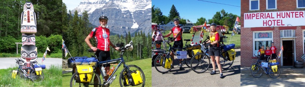
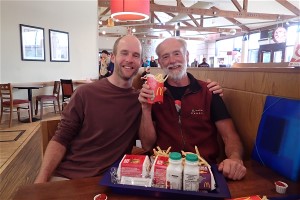
But before we start the story, here are the players:
Kate_______________Steve__________Samy ___________Dave
Kate, Steve’s wife, also known as the “Queen of high gear hill climbing and chain entanglements“.
Dave’s son, Steve, also known as the “Doctor of steep, rough and long shortcuts“
both setting out from Deep River, Ontario
Samy, who before we started, had a longest bike ride of 14 kms, and also known as the “Doctor of the selfie” starting the journey from Ottawa.
And finally, me! I think the young folk regarded me as “The ancient mariner“!
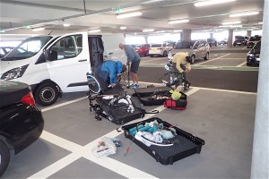
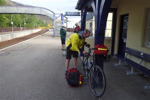
Assembling the bikes at Heathrow….
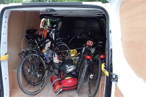
…..packed in the van, and ready to go!!
We all met at Heathrow, and rented a van to take Dave and Steve plus all the bikes up to Inverness. Kate and Samy flew to Aberdeen, and thence by rail also to Inverness. There was a “small” 5 hour delay in that the bikes of both Kate and Samy did not make it onto their plane from Toronto! Luckily, there was another same day flight later! We spent the night in Inverness where Dave and Steve arrived after midnight, having driven with only a few short fueling stops. Despite the late night, we were all ready early next morning, panniers packed and ready for the trip to John O’Groats. We were collected from the hotel by The John O’Groats Bike Transport Co. to transport both ourselves and bikes to John O’Groats. What a great service and we thoroughly recommend them!
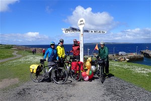
At kilometer “0” the famous signpost at John O’Groats. Just before it started to rain!
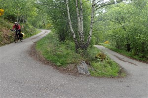
After a photo shoot we began our journey, heading off straight into rain and a 35 knot gale force headwind. We had planned a very short day not starting the ride until late afternoon, and had not gone far when Kate’s rear wheel decided to slip out of the frame every time she used the rear disc brake! Stopped overnight at the Northern Sands Hotel, Dunnet Head having cycled 20 kms with a modest 160 metres cumulative elevation gain. We had no idea of what was to come!
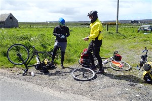
The first of many rear wheel problems for Kate
Set out early 6:30 am next morning and rode to Thurso looking for breakfast. This accomplished we rode west along the coastline on the A836 for 27 kms, then headed south on the A897. We soon reached the Helmsdale River valley following it to Helmsdale itself where we spent the night.
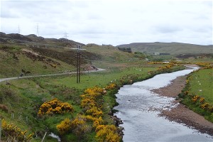
Helmsdale River Valley
But, about half way, Steve broke a spoke on his rear wheel! One of his heavy bags went onto Kate’s bike, and one onto Samy’s. With the load reduced, Kate then rode Steve’s bike to Helmsdale, and Steve used Kate’s bike. (Both had to have a considerable change to the saddle heights!) Day 2 was 103 kms with 695 metres cumulative gain.
This was Samy’s lifetime first 100 km day!
Samy after his first 100 km day!
There was no way Steve’s bike would make it to Inverness, so next day we went to the Railway Station where he and bike caught the first train to Inverness. The rest of us tried to find local bike paths to keep us off the A9 into Inverness. Almost succeeded, but after lunch in Alness, we missed the continuation of the bike route.
Steve plus bike waiting for the train to Inverness
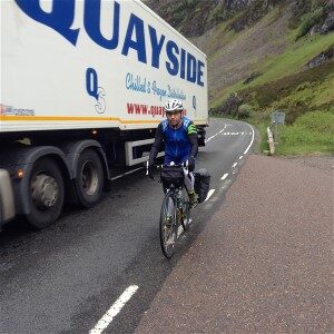
As a result, we found ourselves joining the A9 just before the Cromarty Bridge – very heavy traffic in both directions! Here we must post a note of thanks to all those Scottish drivers stuck behind us patiently waiting for a gap in the traffic such that they could pass us with 2 metres clearance! Not one of them tried to squeeze past!
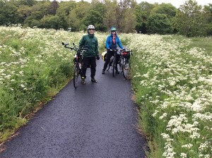
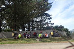
Samy & Kate on the part of the bike route we did manage to find!
The bike route we did find was very picturesque – wish we could have found the complete route! In the meantime, Steve got his bike fixed and rode out to meet us at the Tore traffic circle, from where we took the bike route over the Kessock Bridge and into Inverness. Day’s total was 113 kms and 782 metres cumulative gain.
The high point on Steve’s route south of Inverness! A climb of 271 metres over 13.5 kms. We could not see Loch Ness!
Departing Inverness next morning Steve’s choice of route did not go south alongside Loch Ness, but headed inland for a day’s extensive climbing following Essich Road to the first high point of the day at 271 metres.
Kate on the descent to Inverfarigaid – note the farm track!
This route eventually joined the B862 for a short way until just past Loch Ceo Glais and a right turn down to Inverfarigaid where we joined the B852, then B862 all of which was steadily uphill to a high point of 405 metres! Then down to Fort Augustus for lunch.
Dave negotiating the series of hairpins just prior to joining the B852.
It was 2:30pm by the time we had finished lunch, and another 65km to go. We followed the Caledonian Canal and the Great Glen Way which involved many kilometers of dirt tracks and hills – one so steep that Kate with her high gears came to a clipped-in standstill, and fell off!
The Canal sections were scenic and although gravel, were a great part of the day’s ride. Arrived in Fort William late evening, cloudy and rain. Days totals were 113 kms and 1,222 cumulative metres gain.
Cycling the Caledonian Canal south of Fort Augustus.
Original plan was to hike Ben Nevis next day, but the mountain was hidden in the clouds, so made a “rest” day instead! It did at least give Kate an opportunity to get her rear wheel and gears fixed.
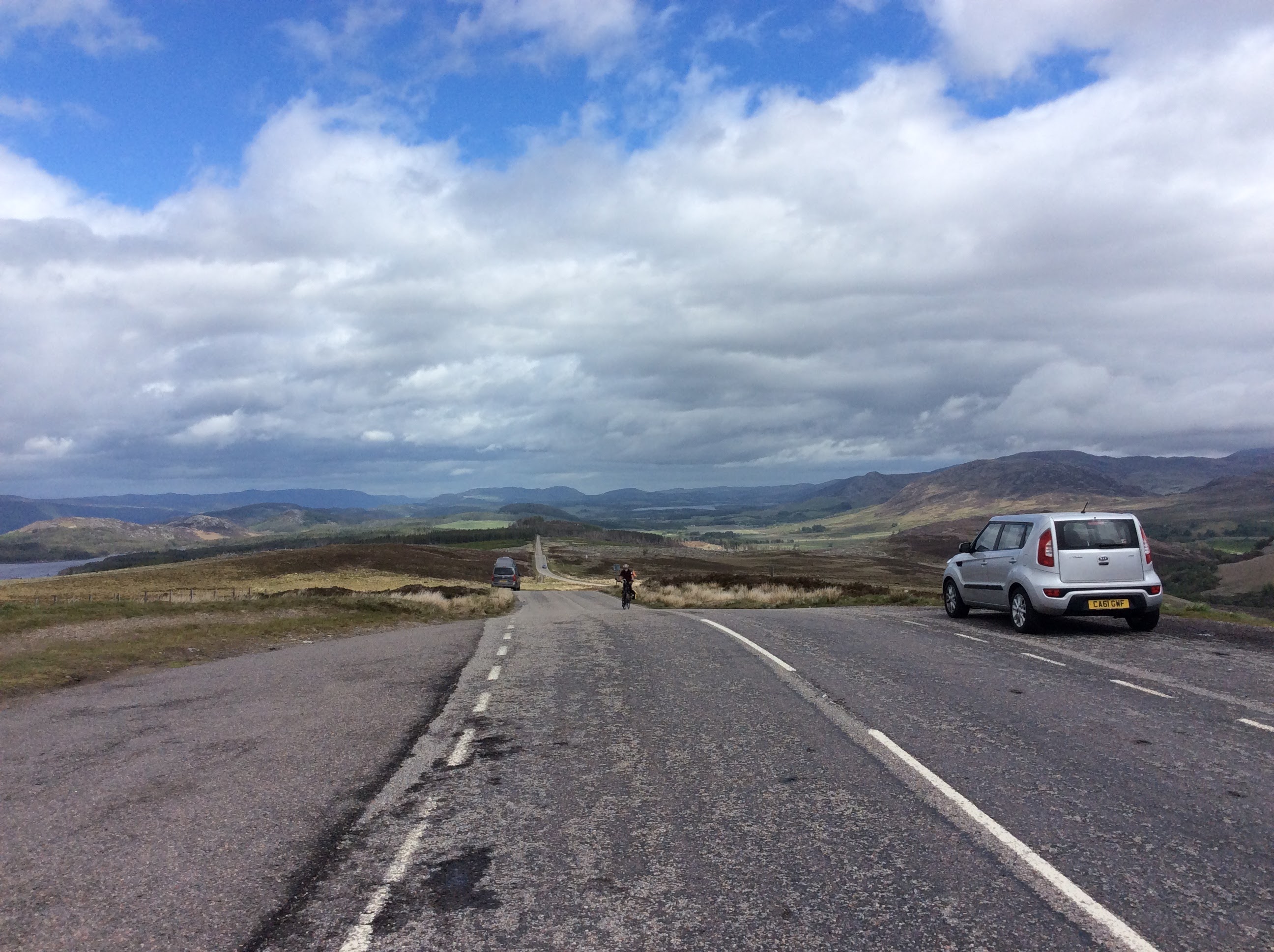
The following day started out cloudy, but no rain as we headed for the long climb up the Pass of Glencoe at 308 metres.
All the way from Fort William to Crianlarich we followed the main highway, and consequently, a lot of traffic. Again, all the local drivers were very good at giving us plenty of room as they passed – in many cases, waiting for oncoming traffic to clear so they could use the opposite lane to pass us with about 2 metres clearance. I hope some Canadian drivers are reading this!
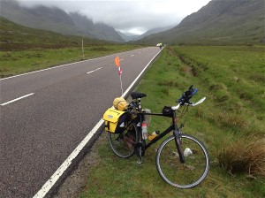
Had to have a photo of the iconic Glencoe!
The only vehicle to try and squeeze past was an RV (camper van) who hit my handlebar mirror with his big inside wing mirror! Luckily I was going slow, so managed to stay upright. No, he was not a Scot, but a visiting Swiss tourist!
After that, it was a nice ride through the mountains, lots of great scenery to our overnight in Crianlarich.
77 kms and 715 metres climbing.
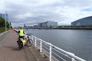
In the centre of Glasgow
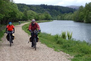
The next day was a welcome “flat” ride, but started on a very narrow road, rain and traffic! Eventually reached the West Loch Lomond Trail, and then the Clyde River tow path. Once in Glasgow, the bike routes were well signposted, and we reached the city centre without following a single busy road! Leaving the city to the south the bike route was also well marked, but we had to cross 3 ridge lines, one of which was a steep dirt trail at 26% ! But, it was not raining and we did see some sunshine. 105 kms with 677 metres of climbing.
Father’s Day and the only place for Steve to pay for dinner was MacDonalds!
Next day saw us all soaked in heavy rainfall! Found our way into the back of a motorway service area for lunch. We had our wet clothes hanging over empty chairs and dripping puddles onto the floor. Followed a wide “A” class road that had no traffic as it was parallel to a Motorway. Stopped for the night at Johnstonebridge about 10 kms south of Moffat. Made 103 kms and 860 metres climbing.

Farewell to Scotland, hello England!
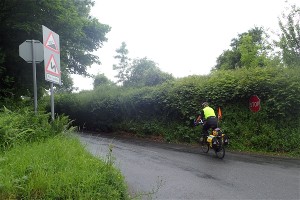
Farewell to Scotland, and into England. Several instances of cars passing much too close – as we had been warned by the Scots! Lots of hills, but none too long and we were in Carlisle. Again, followed a “bike” route that led us to a railway overhead footbridge! No way we were getting heavily loaded touring bikes up and down that! Back to a busy city road. Heavy cloudburst in the afternoon, more chain problems for Kate, and we were in Penrith for the night. 88 kms and 612 metres climbing.
Not 2 metres here!
Next day an uneventful ride to Kendal via Shap on the A6, then SE to Kirkby Lonsdale which took us across about 14 ridge lines where the only reason to go up, was to go down the other side! 67 kms and 936 metres climbed.
Dave starting the long climb south of Bentham
Next morning south to Burton Lonsdale. Then we began to climb, and climb due south on Slaidburn Rd, Lord’s Cl Rd, Lythe Fell Rd, The Skaithe and Slaidburn for breakfast at the The Hark to Bounty Inn. This is quite an iconic route cresting at 431 metres about 12 kms from Slaidburn. It is rumoured that Sir Bradley Wiggins trained for the Alps along this route! From that high point, the road drops to 150 metres in Slaidburn and back up to 350 metres after leaving! Continued through Blackburn and Bolton (heavy traffic) and on to a motel just south of Bolton. 97 kms and 1600 metres climbed.
There then followed a nice easy day, south to Nantwich, then SE to overnight in Wybunbury at a pub just next to the The leaning church tower 77 kms and only 410 metres climbing! Now we are getting too relaxed as this day was also not so difficult, but lots of small hills to Much Wenlock. Then a sharp 15% ascent onto the B4378 to overnight in Brockton. 78 kms and 660 metres climbed.
Dave starts one of many 20% hills.
Next day mostly on country roads, but many hills including two at 20%. Through Cleobury Mortimer and on to Worcester. Only 70 kms but 877 metres of climbing.
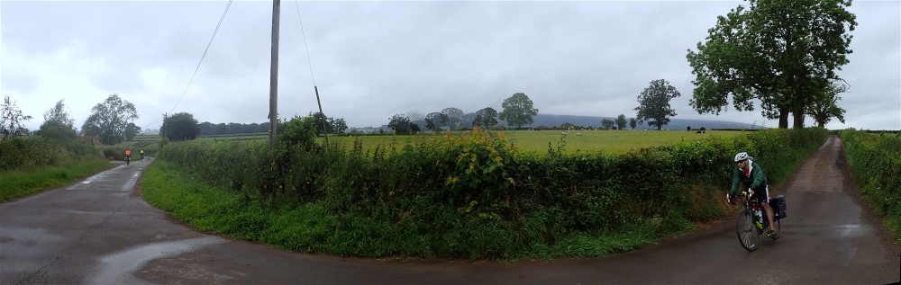
One of Steve’s panoramas – just in time before it rained again! Location is just south of Aston Botterell @ 52°26’28.92″N 2°31’57.959″W
Next day south through Gloucester for lunch, then on to Bristol. Not so good with bike routes here, and rode through the city centre in heavy traffic on our way to a hotel at Bristol Airport. 107 kms and 600 metres climbed.

Samy at the scene of the battle of Tewkesbury 4th of May, 1471.
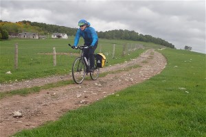
The ride from Bristol Airport to Minehead was quite flat for the most part, but there were a few hills, especially where we followed one of Steve’s “short cuts”! Overnight in Minehead. 88 kms and 613 metres climbed.
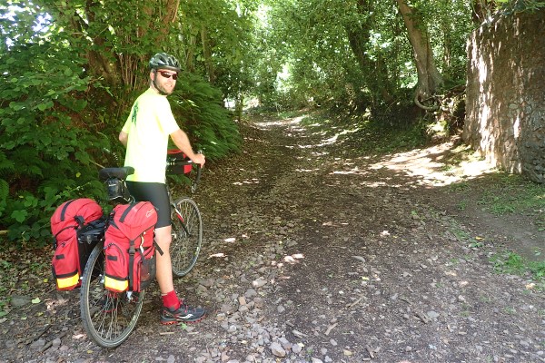
One of Steve’s more memorable “short cuts”! Note the rough track!
The next day will be remembered as the “Day of Hills”! We left Minehead heading west on the A39, but not wishing to follow this busy route, turned South towards Blackford, then generally SW to Wide Mouth Bay.
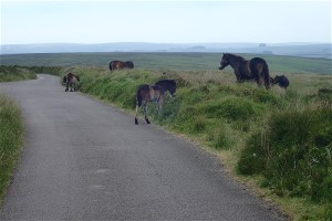
Wild ponies on Exmoor
Crossing Exmoor involved one steep hill after another, but we did see many ponies. Once in Wide Mouth Bay we had difficulty finding the caravan park where we had booked accommodation, and spent quite some time cycling around in the dark! This was our record day in terms of climbing! 110 kms and 2,230 metres cumulative elevation gained.
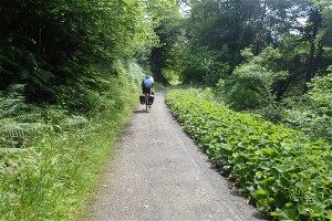
The Camel River Traill
Next day we headed south on quiet country roads just east of the A39. Found a nice trail following the Camel River from Wenford Bridge to Padstow. There followed some big hills, past old tine mines, and eventually along the coast to Newquay. The coast road of course, went down to each small seaside village, then back up again about 6 times with climbs between 50 and 90 metres. Total for the day 91 kms and 1,102 cumulative metres gained.
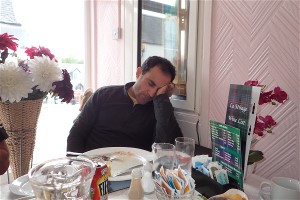
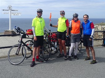
Last lunch together before Penzance
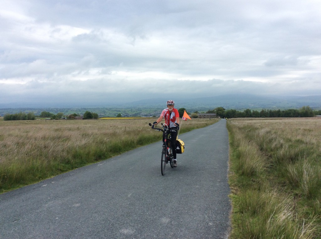
Final day! Nice quiet roads staying off the busy route. Lunch on the road, then more hills to Penzance where we cycled along the seawall trail to the town centre. Then a long 10% climb out of the town, followed by more ridges until finally we arrived at Land’s End! Day’s total 83 kms and 1,116 metres of climbing.
_______________ Land’s End ! ______________
Final statistics:
No. of riding days: 18
Total kms: 1,542
Max kms in one day: 116
Max elevation in one day: 2,230 metres ( 7,316 feet)
Total metres elevation gain: 15,083 (almost twice the height of Everest!)
Total calories: 50,590
Max calories in one day: 4,981
For route information: Route Details
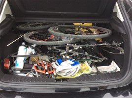
We chose to fly in and out of Heathrow, and elected to start from John O’Groats. The airlines all required that we box the bicycles, so the first problem was somewhere to store the boxes for 4 weeks while we were on the tide.
Do not even think about “Left Luggage” at Heathrow – cost is £10 per box per day!! By far the best option is to use Big Yellow Storage located 179 – 191 Staines Road, Hounslow, Middlesex TW3 3LL and telephone no. 020 8572 3456. They also have a direct email: hounslow@bigyellow.co.uk. Only 7 km from Heathrow.
Now, how to get ourselves plus bikes to Scotland. The railways were useless, in that all responses carried the note that “bicycles would only be carried if space was available”. This is a big problem when flights have to be booked! Railways were also very expensive. So, there being 4 of us, simply rented a van to take bikes plus driver and passenger to Inverness. The other two flew to Aberdeen, then train to Inverness. Best rental option Europcar Van Hire for a one way trip to Inverness. They are located at 79 New Rd, Hayes, Greater London, UB3 5BQ Telephone No. 0208 8977150 They are only 1 km from Heathrow, so walk there, get the van, return to Heathrow, collect the bikes in their Boxes, drive to the storage, drop off boxes and assemble bikes. It is a 10 hour drive to Inverness Airport (van key drop box inside Airport). Be aware this is a “commercial” vehicle and on “A” class roads your speed limit is 5 mph below the posted maximum speed!!
Next step is to get from Inverness to Penzance, and here we really do recommend The John O’Groats Bike Transport Co. located at The Pavilion, Bellfield Park, Inverness, IV2 4SZ telephone 01463 419160. They can also be contacted via their email address: info@JohnOGroatsBikeTransport.co.uk
Finally, how to get yourselves and bikes back to Heathrow. Again, Europcar – but unless you are very lucky, no vans available, so hired 2 cars. Use their Penzance Office Europcar Car Penzance located at Penzance Railway Station, Albert street, TR18 2NG, Penzance United Kingdom. Telephone 0371 3845975 Phone ahead once you are close enough to be sure of your arrival date.
One last footnote! If you arrive at Land’s End late in the day, and need to get back to Penzance quickly, there are some taxi services available. We used Anytime Taxis Telephone 01736 888888 as they have vehicles that can carry 2 passengers plus 2 (dismantled) bicycles.
One car – 2 bikes! Penzance to London!
If you use any of this information, please let us know if anything needs updating!