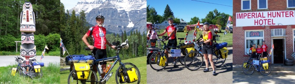
Go to: 2015 End2End (LEJoG) Summary:
Go to: 2010 San Juan Islands and Cascades Ride Summary:
Go to: 2008 Cross Canada Trip Summary:
Go to: 2006 Dave’s Icefield Parkway Ride:
Go to: 2005 Cross Canada Trip Summary:
Day 1
John O’Groats to Dunnet. Follow A836 and look for National Bike Route 1 which runs parallel south of A836. 19.5 kms and 159 metres gained.
Day 2
Continue on A836 to Thurso. Take B874 (National Bike Route 1). 2.6 kms out of Thurso this B874 turns south. Go straight on to National Bike Route 1. Follow and join A836 near Reay. Stay on A836 and turn left to A897 (south) just before Halladale River bridge. Follow A897 all the way to Helmsdale. 103 kms and 695 metres climbed.
Day 3
Follow A9 south to the Cromarty Bridge. Turn right onto A862 to Dingwall, stay on A862 south through Muir of Ord, Windhill. Go left on A862 at junction with A831. Follow A862 to Inverness. Most of this route follows National Bike Route No.1 120 kms and 782 metres climbed.
Day 4
An option is to follow the A82 along the shore of the Loch to Fort Augustus which minimizes elevation gain. Otherwise depart Inverness on Island Bank Rd (B862), left onto Stratherrick Rd, straight across B8082 at traffic circle onto Essich Rd. Follow past Loch Ashie, bear left onto B862. At 21.3 kms from Inverness, look for dirt track heading SSW to Inverfarig. After a series of paved hairpin bends, turn left onto the B852. Follow B862 to Fort Augustus. Follow the canal path south until the A82. From here the A82 is busy and not very wide. We chose to follow the Great Glen Way (Bike Route 78) down the west side of Loch Oich. Look for signposts. At the south end of this Loch, take the canal path and bike route signs into Fort William. 107 kms and 1,222 metres climbed.
Day 5
Rest day and bicycle repairs. Much too cloudy to climb Ben Nevis.
Day 6
Easy to navigate this day. Follow the A82 up through Glencoe and on the Crianlarich. 83 kms and 718 metres climbed.
Day 7
Follow the A82 south to Loch Lomond. Look for the West Loch Lomond Bike Route to follow the shoreline to Belloch. Take the Clyde River path all the way to the centre of Glasgow. Follow the river to the Exhibition Centre and take the footbridge across the Clyde. Look for, and follow bike route signs which stay away from the busy roads. We crossed Glasgow to the B767 south, crossed the A726 and continued to Eaglesham overnight. Distance 104.5 kms and 677 metres climbed.
Day 8
Follow quiet country roads and the B7086 SE through Strathaven to Lesmahago. Follow the B7078 south along the side of the M74. Stay on this route to Johnstonebridge for overnight stop. 103 kms and 859 metres climbed.
Day 9
Continue south alongside the M74 to Carlisle. Follow bike route signs through the city, then south to Blackwell, and Durdar. Turn Left in Durdar, then next right to go south and alongside the M5. This road crosses over the M5 north of Penrith, and joins the A6 into Penrith. 88 kms and 612 metres climbed.
Day 10
Follow A6 south out of Penrith. At Eamont Bridge turn right onto B5320 and follow through Butterwick, Brampton, Rosgill to Shap. Join the A6 south to Kendal and join the A65, but exit left immediately before the river bridge. Follow roads south to join the A65 south of Kirkbie Kendal School Grounds. After 150 metres bear left onto Oxenholme Rd B6254. Follow through Middleshaw to Old Hutton. After 200 metres turn left and cross over M6 (If under M6 you missed the turn!) Follow road east, then SE and road becomes Old Scotch Rd. Follow south to Old Town and rejoin B6254 to Kirkby Lonsdale. 67 kms and 936 metres climbed.
Day 11
Exit Kirkby Lonsdale on A65 heading SE. Turn right (south) at Ireby to Burton Lonsdale. Turn left onto Duke St to Low St, then left onto Burton Hill and cross over River Greta and immediateb left onto Bentham Moor Rd. Follow to Bentham. Follow signs to Bentham Railway Station on Thickrash Brow Rd which becomes Slaidburn Rd, Lord’s Cl Rd, Lythe Fell Rd, The Skaithe and Slaidburn. Exit Slaidburn on Church St (south) which becomes the B6478 through Newton-in-Bowland, Waddington and into Clitheroe. Exit Clitheroe on the A671 heading south. Turn right onto A59 and follow to turn left onto the A666 at traffic circle to Blackburn. Follow A666 through Blackburn to the A58 around Bolton generally to the Westhoughton Area. 97 kms and 1,546 metres climbed.
Day 12
This routing follows minor roads and bike routes. Check on a map before setting out or use GPS course! Exit Bolton off the A58 west of Bolton to south on Platt Ln, North Rd and Bag Lane to Atherton (or use the B5235 off the A58 about 800 metres after Platt Ln). In Atherton, turn left at Mealhouse Lane, then right onto A577. Bear left onto Shuttle St (one way system), right on Primrose St., cross right on A577 then left onto Astley St heading south. Stay on this road to T-Junction and left onto A572, turn right onto Higher Green Ln, this becomes Lower Green Ln. Turn left after Black or Moss River Bridge onto Rindle Rd. Follow south to Astley rd, cross M62 then right onto A57.. Turn left onto Warburton Bridge Rd to cross river. Follow minor roads south through High Legh, Marston, Wincham towards Northwich. Look for bike route along banks of River Weaver to A556 and turn left to Moulton, heaad back to river and follow bike route south to Winsford. Use minor roads to Church Minshull and go south on B5074. Cross A51 and stay east of Nantwich on Nantwich Bypass. Follow Wybubury Ln tinto Wybunbury. 77 kms and 411 metres.
Day 13
Exit Wybunbury on B5071. Head south to join A529 at Hatherton and through Audlem and Adderley to the A53. Right onto A53 and follow to Shawbury. Turn left onto Poynton Rd headin south and past Little Wytherford. Use minor roads to Haughton and Upton Magna on Peltham Rd, cross A5 stay on Peltham Rd to Atcham. Turn right across River Severn, then immediate left (south) on minor roads to Cross Houses and join the A458 heading SE. At Cressage turn left onto Sheinton Rd tand follow minor roads to join A4169. Go south to Much Wenlock and onto B4378 to Brockton. 78 kms and 661 metres cumulative elevation.
Day 14
Rest day. Visit Iron Bridge and also the Victorian Village – recommended!
Day 15
Exit Brockton east on minor road to Weston, another minor road SE to T-Junction, turn right (south) to Ditton Priors. Then South Rd to Oakwood Rd to B4364 at Cleobury North. After this village, exit left onto minor road heading SE to Aston Botterell, more minor roads Se to Neen Savage and join B4363 heading SW to A4117 north of Cleobury Mortimer. Follow A4117 and exit south on B4202. Cross A456 at Clows Top, continue B4202 south to join A443 heading south to Great Witley. Fork right onto Worcester Road, then turn right onto B4197 to Martley. Follow minor roads SE to turn left on the A44 just south of Upper Broadheath. Through traffic circle to A4440 , through another traffic circle to Hams way, through one more traffic circles to Temeside Way – most of which have a bike path at roadside. Cross River Severn and turn right onto A38. Follow to Kempsey. 708 kms and 877 metres climbed.
Day 16
Continue south on A38 through Tewkesbury and into Gloucester onto A4301 then Bristol Rd heading south. Cross A38 onto B4008 to join A38 to Bristol where it becomes Gloucester Rd. This is a busy road, but we followed through Bristol centre and on to Bristol Airport for overnight. 107 kms and 600 metres climbing.
Day 17
Continue south on A38 until north of Edithmead, turn left onto Harp Rd and cross M5. Follow minor roads south and turn right at Mark Causeway (B3139). Follow through Bason Bridge, East Huntspill, Woolavington and take Crancombe Lane SW to the A39 head south through Bridgewater and stay A39 west (Quantock Rd). After west Quantoxhead, take right fork (B3191) to Doniford, Watchet and past Butlins to Minehead. Go left on The Avenue, Bampton St., and Cher to join the A39. Distance 88 kms and 343 metres climbed.
Day 18
Head west on A39 for about 4 kms, then about 500 metres after the left turn to Tivington, turn left to Luccombe and follow this minor road to a high point of 495 metres, then descend 225 metres down to Exford. Exit this town west on B3223, but immediately after crossing the River Exe, turn left. Go 300 metres and turn right to head WSW and follow to cross the B3223 following Chibbet Hill over small bridge (Pennycombe Water). After about 600 metres take left fork onto Landacre Ln heading south, cross River Barle, stay on road which becomes East St, cross River Mole and go through North Molton on Fore St. About 200 metres after leaving North Molton, take left fork and cross A361 into South Molton. Turn right at East St, right out of town centre, left onto B3227 heading west (Nadder Ln.) Follow B3227 and cross River Taw at Umberleigh turning right onto A377 in front of The Rising Sun Hotel (good place for lunch!). After 600 metres on the A377, turn left onto B3227 through Atherington, Langridge, High Bullen and into Great Torrington. Join A386 heading west for 300 metres, then turn left onto White’s Lane, right onto Mill St, left onto B3227 and cross River Torridge. Follow B3227 through Langtree and at Stibb Cross take left fork to A388 and follow to cross River Waldon. Take immediate right turn to go west on minor road through Youldenmoor Cross, cross B3254 and continue to Stratton on Diddies Rd., Union Hill, turn left on A39, then right onto A3072. Go through Bude on Bencoolen Rd, beomes Vicarage Rd, becomes Lynstone Rd and finally, Marine Drive heading south to Widemouth Bay. 110 kms and 2,230 metres elevation gained. Most climbing in one day!
Day 19
Follow Marine Drive south until it turns left to join the A39 at Coppathorne and follow A39 south to Wainhouse Corner. Turn left to Eden Methodist Church, and right towards Trengune, follow south over River Ottery, through Trelash and to Hallworthy. Cross A395 and at T-Junction turn right (left is to New Park) After 1.5 kms take sharp left towards Crowdy Reservoir (fo not go straight on to A39). Go through Watergate to St Breward, Row, Lank, Wenford Bridge. Just south of Wenford Bridge, look for signs to the Camel River Trail, and follow this to Wadebridge. Follow bike path to Padstow and take the B3276 to St Merryn, Porthcothan, Trenance, Mawgan Porth. At Trevarrian turn right onto Trevarrian Hill and follow this coastal road into Newquay. 91 kms and 1,102 metres climbed.
Day 20
Follow Tranance Rd out of Newquay and turn right onto B3058, then left onto A392, and right onto A3075 heading south. Follow A3075 through Goonhaven, Perran Well, Perranzebuloe, Penhallow, Three Burrows, Blackwater, then cross A30 onto B3047. Take left fork onto Mount Ambrose, becomes Sandy Lane. Take sharp right into Park Rd, right onto Albany Rd, left onto Raymond Rd, right on Falmouth, immediate left on Trewergie Rd and turn right on W. Trewirgie Rd. Follow to wide fork and fork right towards S Cairn Brea and head west on this road. Follow this route south of railway and turn right on Chapell Hill and into Tincroft Rd. Follow across railway through Camborne and turn south back over railway to Penponds, Barripper, Penhale Rd to Carnhell Green and turn right onto Gwinear Ln to Gwinear, Nanpusket Rd to cross railway, left at Hatch’s Hill to cross A30. Left into Viaduct Hill, becomes High Lanes, St Georges Rd, right on B3302, then left onto B3301, fork left to Chenhalls Rd going south, cross A30, follow Chenhalls Rd and turn left at crossroads to Chapel Hill and cross River Hayle on Tredrea Ln. Follow to cross A394 then immediate right to New Dairy Ln and join Bike Path along coast into Penzance near railway Station. 62 kms and 788 metres climbed. Follow Wharf Rd, The Quay, Battery Rd, Western Promenade Rd, New Rd and Chywoone Hill becomes B3315. Follow to Boleigh, and after about 1.2 kms take right fork to St. Buryan. Left onto B3283 for about 1 km and turn right and follow to join the A30 and follow to Land’s End!! From Penzance to Land’s End 22 kms and 328 metres climbed. Now reverse this route or see the “Logistics” section to get back to Penzance!
For story and photos: Cycle Across Canada goes to UK
2010 San Juan Islands and Cascades Ride Summary:
San Juan Island / Orcas Island / Lopez Island : 183kms
Ferry to Anacortes / Cycle to Concrete WA : 81kms
Washington Pass / Mazama : 146kms
Winthrop / Twisp / Grand Coulee : 188kms
Davenport / Spokane : 159kms
Amtrak overnight to Edmunds Station and Ferry to Kingston, WA
Sequim / Port Angeles (Olympic Discovery Trail) : 143kms
Ferry to Victoria and home via Brentwood/Mill Bay Ferry.
TOTAL TRIP DISTANCE 716kms and 6,054 metres elevation!
For story and photos: San Juan and Beyond
2008 Cross Canada Trip Summary:
British Columbia May 30:
Courtenay/Campbell River/Woss/Port McNeil/Port Hardy
Port Hardy – Prince Rupert via BC Ferries
Prince Rupert/Hazelton/Prince George/McBride/Mt.Robson/Jasper : 1,652 kms
Alberta : Jasper/Edmonton/Calgary/Medicine Hat : 1,044 kms
Saskatchewan : Medicine Hat/Regina/Moosomin : 709 kms
Manitoba : Moosomin/Brandon/Winnipeg/Kenora
Ontario : Kenora/Thunder Bay/Espanola/Baymouth Ferry/Tobermoray/Orillia/
Deep River/Montreal : 2,626 kms
Quebec : Montreal/Quebec City/Edmundston : 654 Kms
New Brunswick : Edmundston/Frederickton/Bayfield/Causeway : 575 kms
PEI : Port Borden/Charlottetown/Pictu : 154 Kms
Nova Scotia : Pictou/Truro/N Sydney : 511 Kms
Newfoundland : Ferry/Argentia Bay/St John’s/Cape Spear/St John’s : 182 kms
TOTAL TRIP DISTANCE : 8,686 kms (5,429 miles)
2006 Dave’s Icefield Parkway Ride:
Jasper August 28th:
Jasper / Lake Louise : 230 kms
Lake Louise / Rogers Pass : 157 kms
Rogers Pass / Revelstoke : 71 kms
Revelstoke / Vernon : 147 kms
Vernon / Kelowna : 50 kms
Kelowna / Vancouver – by Air Canada
Vancouver / Nanaimo – by BC Ferries
Nanaimo / Courtenay : 100 kms
TOTAL TRIP DISTANCE : 755 kms and 4,711 metres elevation
For story and photos: Icefield Parkway
2005 Cross Canada Trip Summary:
Newfoundland May 8th:
St John’s / Gander / Corner Brook / Port Aux Basques : 998 kms
Ferry to Nova Scotia : North Sydney / Antigonish / Pictou : 304 kms
Ferry to PEI : Wood Island / Charlottetown / Port Borden : 131 kms
Confederation Bridge
New Brunswick : Moncton / Grand Falls / Edmundston : 654 kms
Quebec : Riviere-Du-Loup / Quebec City / Montreal : 637 kms
Ontario : Ottawa / North Bay / Sudbury / Sault Ste Marie / Thunder Bay : 2,333 kms
Manitoba : Whiteshell Hwy 17 / Winnipeg / Oak Lake / Moosomin : 531 kms
Saskatchewan : Moosomin / Regina / Saskatoon / Lloydminster : 1,007 kms
Alberta : Edmonton / Hinton / Jasper / Mt Robson : 670 kms
British Columbia : Kamloops / Vancouver / Ferry to Victoria / Courtenay : 1,110 kms
We took the Coquihalla Hwy through BC!! Arrived Courtenay August 26th
TOTAL TRIP DISTANCE : 8,375 kms